Turn Your Marathon GPX Into Wall Art — A Step-by-Step Guide
You already have the GPX file from your race. Here's how to turn that exact route into a framed, print-ready poster in minutes — no design skills required.
All artwork in this article was generated with Cartosketch — an AI tool that re-styles real Mapbox geography and GPS routes.
A medal goes in a drawer. A finisher photo lives on your phone. But the route you actually ran — every turn, every bridge, every brutal final mile — is a line that's uniquely yours. This guide shows you how to turn that line into wall art you'll want to hang.
Why your route makes better art than a generic city map
Generic city posters are everywhere, and they're all the same. Your marathon route is different: it traces a real day, a real effort, a real place you moved through on your own two feet. That's why route art lands as a gift and as a keepsake — the shape itself is the story.
Cartosketch keeps the geometry exact. The streets, the coastline, the park loop — all preserved from real Mapbox data, then restyled by AI. You're not generating a fictional map; you're stylizing the one you ran.
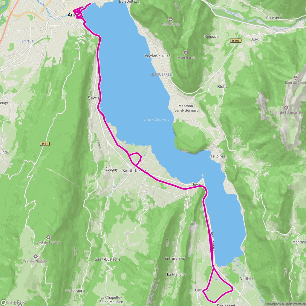 Route map
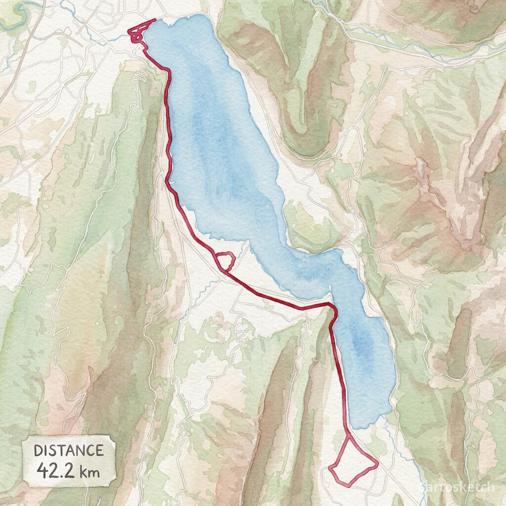 Cartosketch
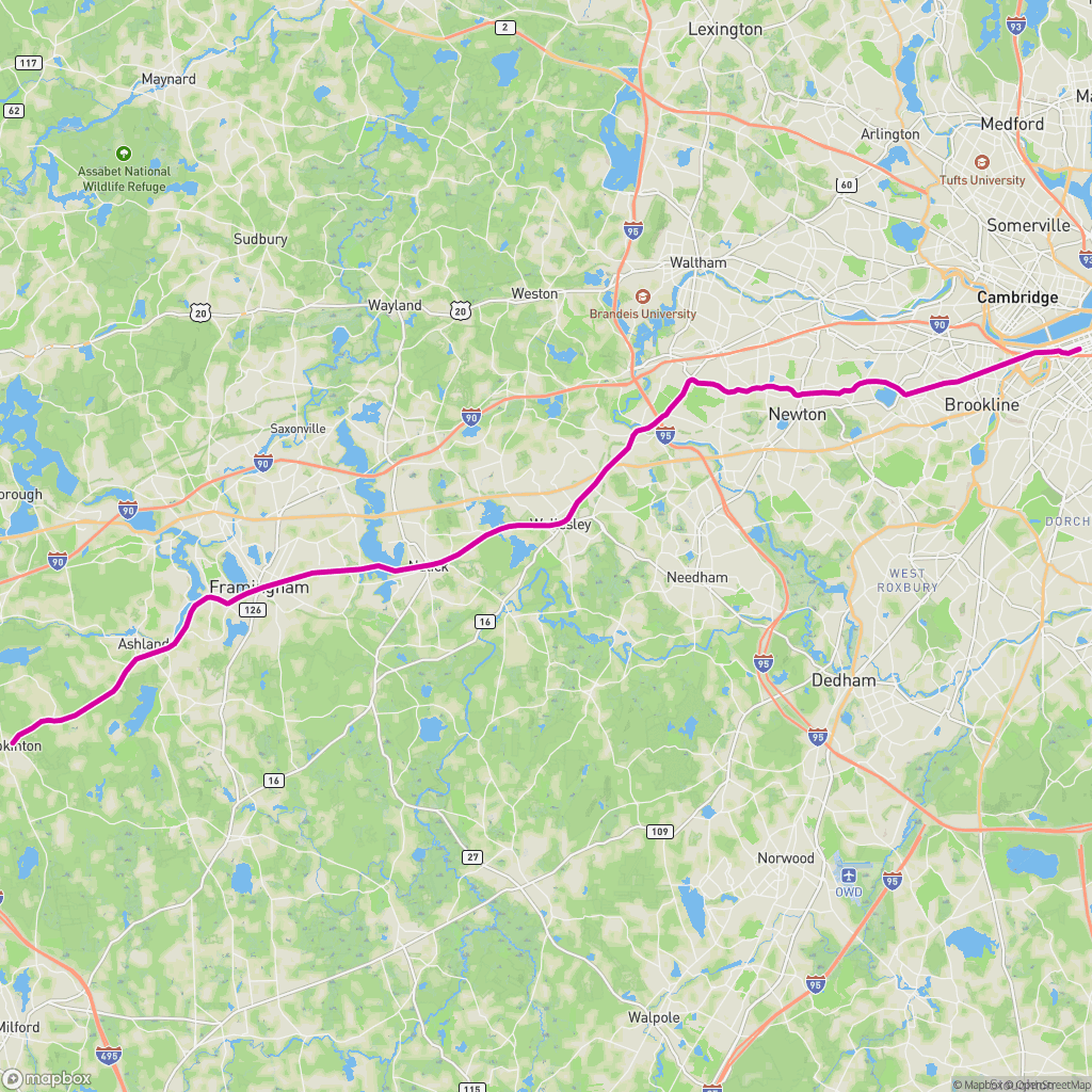 Route map
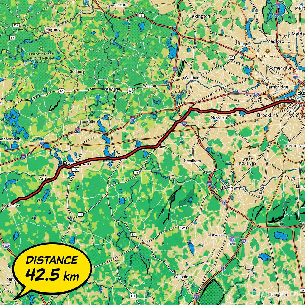 Cartosketch
How to do it yourself
- Export your race GPX from Strava, Garmin Connect, or the event site (any standard .gpx works).
- Open Cartosketch and go to New Route, then upload the GPX. Your exact course renders automatically, with distance and elevation parsed from the file.
- Pick an art style — watercolor and vintage map read as classic keepsakes; comic and blueprint feel bold and modern.
- Generate. In seconds you get a finished piece with a built-in stats card (distance, elevation, time).
- Download up to 4K and send it to any print shop, or frame it at home. Commercial use is included on every plan.
Print sizes & resolution
| Plan | Max resolution | Aspect ratio | Good for |
|---|---|---|---|
| Free | 0.5K | 1:1 square | Social posts, a quick test print |
| Paid | Up to 4K | Any (incl. portrait/landscape) | Framed wall art, large-format prints |
Frequently asked questions
- Is this AI?
- Yes. Cartosketch re-styles real Mapbox geography and your GPS route with an AI model. The route geometry is real and preserved exactly; the art style is generated.
- Is it really my exact route?
- Yes — the rendering is built directly from your uploaded GPX, so every turn matches what you ran. It is not a generic or approximated course.
- Can I print it and sell it?
- You can print it at any size up to the resolution your plan allows, and commercial use is included on every plan. Just don't reuse a race's official name or logo as branding.
- How much does it cost?
- New accounts get one free credit to try it. Paid plans add higher resolution (up to 4K), custom aspect ratios, and more credits.
New accounts get one free credit — no credit card required. Product details
Related use case