Aussie Impressionism Map Art: Paint Any Place in Sunlit Colour
Turn a real harbour, coast, or landscape into Aussie Impressionism map art with warm plein-air light and broken colour. Real Mapbox geography, print-ready up to 4K.
All artwork in this article was generated with Cartosketch — an AI tool that re-styles real Mapbox geography and GPS routes.
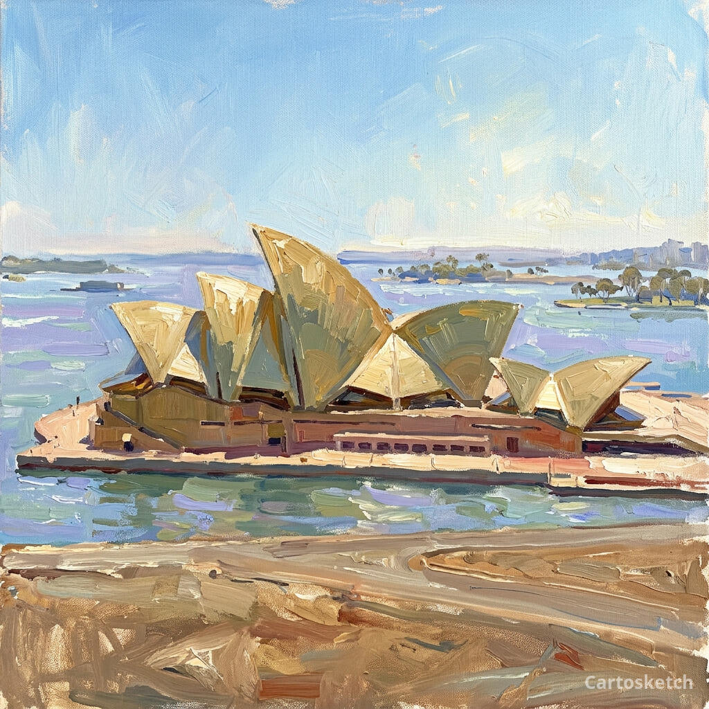
Aussie Impressionism makes a map feel sunlit. Warm ochres, blue-green shadows, and loose strokes turn streets, shorelines, and landmarks into a bright outdoor painting rather than a technical diagram. It is especially at home around harbours and coastlines, where hard architecture meets open sky and reflected light. This guide shows how to turn any real location into map art inspired by Australia's Heidelberg School.
A short history of Aussie Impressionism
Aussie Impressionism is closely associated with the Heidelberg School, a group of artists who worked around Melbourne and Sydney in the 1880s and 1890s. Tom Roberts, Arthur Streeton, Charles Conder, and their peers painted outdoors to catch fleeting weather, intense sunlight, and the distinctive colours of the Australian landscape. Their 9 by 5 Impression Exhibition in Melbourne in 1889 presented small, immediate studies painted largely on cigar-box lids. The movement adapted European plein-air ideas to local light and terrain, helping establish a visual language that felt unmistakably Australian.
Why Aussie Impressionism works on a map
A map view naturally divides into broad shapes — water, land, streets, roofs, and sky — that respond beautifully to broken brushwork and shifting colour. Warm sunlight can pick out a landmark while blue-violet shadows hold the surrounding city together; eucalyptus greens and dusty ochres keep the palette airy rather than glossy. The style works best for harbours, beaches, river cities, open parks, and architecture with a strong silhouette.
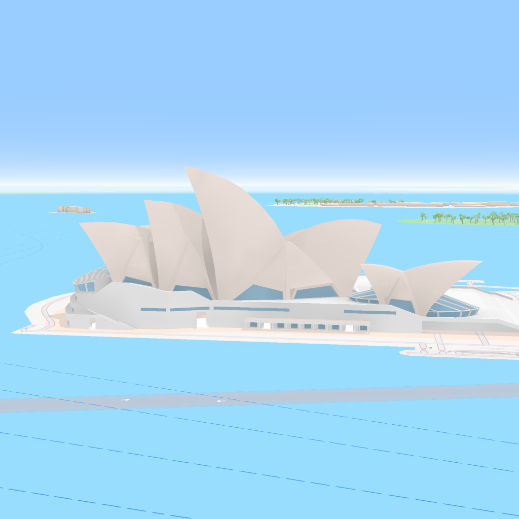
The geography stays exact. The Opera House footprint, the edge of Bennelong Point, the harbour, and the surrounding city all come from the real Mapbox view you frame. AI changes the light, colour, and painted surface; it does not replace Sydney with a generic coastal scene.
 Cartosketch
Mapbox
Cartosketch
Mapbox
How to make your own
- Open Cartosketch → New Map, search the place or drag the map to frame it.
- Pick Standard or Satellite; set zoom, bearing, and pitch so the landmark or shoreline reads clearly.
- Choose the Aussie Impressionism style.
- Generate — in seconds you get a finished piece with the real geography preserved.
- Download up to 4K and print or frame it. Commercial use is included on every plan.
Print sizes & resolution
| Plan | Max resolution | Aspect ratio | Good for |
|---|---|---|---|
| Free | 0.5K | 1:1 square | Social posts, a quick test print |
| Paid | Up to 4K | Any (incl. portrait/landscape) | Framed wall art, large-format prints |
Frequently asked questions
- Is this AI?
- Yes. Cartosketch re-styles real Mapbox geography with an AI model — the layout is real and preserved; the Aussie Impressionist light, colour, and brushwork are generated.
- Is it the real place, or a generic illustration?
- The real place. It is built from the actual map view you frame, so coastlines, streets, building footprints, and landmarks match the location.
- Can I print and sell it?
- Print at any size up to your plan's resolution; commercial use is included on every plan. Just don't reuse an official name or logo as branding.
- How much does it cost?
- New accounts get one free credit. Paid plans add higher resolution (up to 4K), custom aspect ratios, and more credits.
New accounts get one free credit — no credit card required.