Ink Wash Map Art: Turn Any Place Into a Misty Shan Shui Scroll
Turn a real place — a river bend, a mountain range, an old harbour — into a minimalist ink wash map. Real Mapbox geography, brush-and-mist look, print-ready up to 4K. Here's how, with a before-and-after example.
All artwork in this article was generated with Cartosketch — an AI tool that re-styles real Mapbox geography and GPS routes.
Ink wash is the quietest way to put a place on your wall. Instead of filling every street and block, it leaves space — soft grey gradients, a few confident strokes, and a lot of empty paper for the eye to rest on. The result feels less like a map and more like a scroll painting of somewhere you love. This guide shows how to take any real location and restyle it into an ink wash map worth framing.
A short history of ink wash
Ink wash painting — shui-mo in Chinese — grew out of the Tang and Song dynasties, when scholar-artists set out to capture the spirit of a landscape rather than its exact likeness. Working with nothing but black ink and water on absorbent paper, they prized qiyun, the rhythmic life of the brushstroke, and liubai — the deliberate art of 'leaving white,' letting empty space carry as much meaning as the marks. Carried east to Japan, the same tradition became sumi-e, closely tied to Zen practice and the beauty of restraint. For more than a thousand years the genre has been about one idea: suggest the whole with a few strokes, and trust the viewer to feel the rest.
Why ink wash works on a map
A map is dense with information; ink wash is the art of leaving things out. That tension is exactly why it works. Ridgelines become a few tapering strokes, rivers turn to pale ribbons of unpainted paper, and mist swallows the clutter at the edges so only the essential shapes remain. A monochrome palette — charcoal to silver-grey — reads as calm and timeless on a wall. It suits dramatic natural terrain best: karst peaks, river valleys, misty coastlines, and old towns with mountains behind them.
The geography stays exact. The bend of the river, the line of the ridges, the layout of the streets — all preserved from real Mapbox data, then repainted by AI in ink and mist. You're not generating a fictional landscape; you're stylizing the real place you picked.
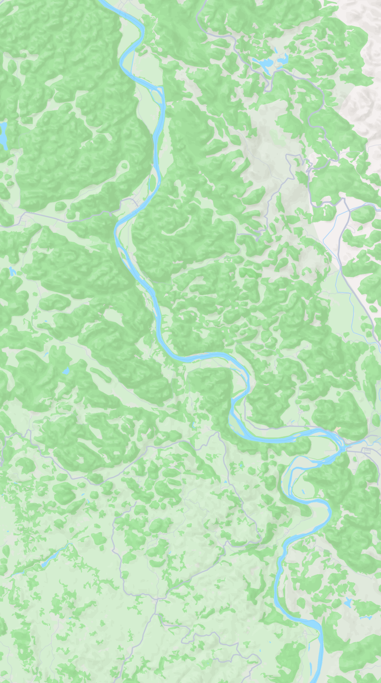
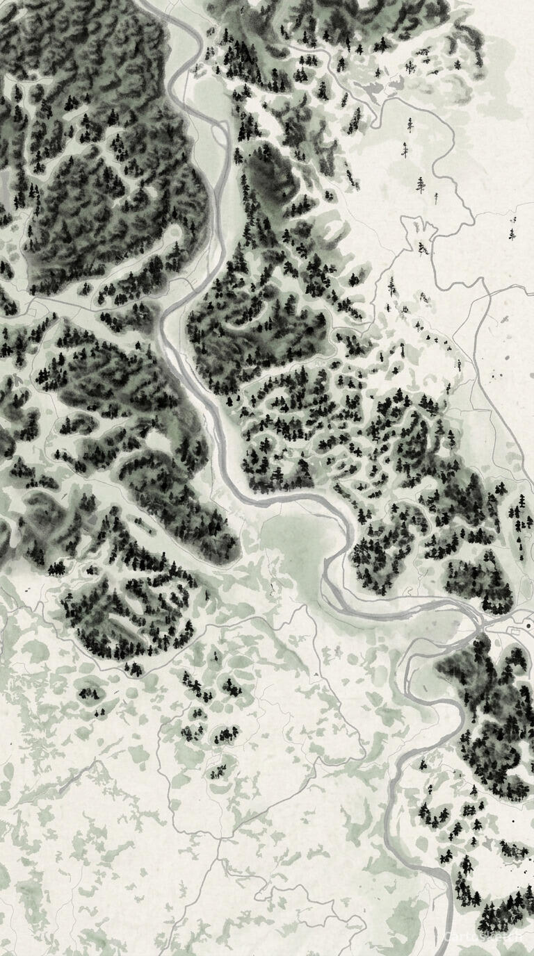 Cartosketch
Mapbox
Cartosketch
Mapbox
How to make your own
- Open Cartosketch → New Map, search the place or drag the map to frame it.
- Pick Standard or Satellite; set zoom, bearing, and pitch until the composition feels right.
- Choose the Ink Wash style.
- Generate — in seconds you get a finished piece with the real geography preserved.
- Download up to 4K and print or frame it. Commercial use is included on every plan.
Print sizes & resolution
| Plan | Max resolution | Aspect ratio | Good for |
|---|---|---|---|
| Free | 0.5K | 1:1 square | Social posts, a quick test print |
| Paid | Up to 4K | Any (incl. portrait/landscape) | Framed wall art, large-format prints |
Frequently asked questions
- Is this AI?
- Yes. Cartosketch re-styles real Mapbox geography with an AI model — the layout is real and preserved; the ink wash look is generated.
- Is it the real place, or a generic illustration?
- The real place. It's built from the actual map view you frame, so rivers, ridgelines, and landmarks match reality.
- Can I print and sell it?
- Print at any size up to your plan's resolution; commercial use is included on every plan. Just don't reuse an official name or logo as branding.
- How much does it cost?
- New accounts get one free credit. Paid plans add higher resolution (up to 4K), custom aspect ratios, and more credits.
New accounts get one free credit — no credit card required.