Vintage Map Art: Turn Any Place Into an Antique Explorer's Chart
Turn a real place — your city, a coastline, an island — into a vintage antique map on aged parchment. Real Mapbox geography, copperplate linework and old-world colour, print-ready up to 4K.
All artwork in this article was generated with Cartosketch — an AI tool that re-styles real Mapbox geography and GPS routes.
Vintage style turns a map into a treasure from the Age of Exploration. Sepia-toned parchment, fine copperplate linework, and the warm patina of centuries make a modern place look like a chart pulled from a sea captain's drawer. It is nostalgic, romantic, and full of character — a beautiful way to give a familiar place the weight of history. This guide shows how to turn any real location into a vintage map.
A short history of vintage cartography
The look we call "vintage" comes from the great age of exploration, roughly the 15th to 18th centuries, when mapmaking was equal parts science, art, and storytelling. Navigators relied on portolan charts laced with radiating compass lines; engravers cut the plates by hand, giving maps their fine, deliberate linework. Cartographers filled the margins with ornate cartouches, decorative compass roses, sailing ships, and the occasional sea monster lurking in uncharted waters. Printed on rag paper that yellowed and softened with age, these charts blended hard navigation with pure imagination — which is exactly the romance a vintage map brings to a place you know.
Why vintage style works on a map
A vintage treatment flatters almost any location. Aged parchment tones, muted ochres and sea-greens, fine engraved lines, and hand-lettered character turn ordinary streets and coastlines into something that feels collected rather than printed. Coastlines gain a hand-drawn waver, water fills with subtle hatching, and the whole piece settles into a warm, antique calm. It suits coastal cities, islands, historic towns, and anywhere with a sense of journey or discovery.
The geography stays exact. The shape of the lagoon, the line of the Grand Canal, the layout of the islands — all preserved from real Mapbox data, then re-engraved by AI in old-world style. You're not generating an imaginary land; you're stylizing the real place you framed.
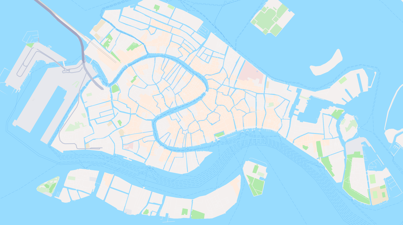
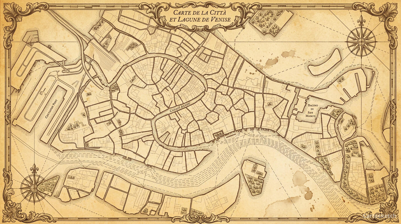 Cartosketch
Mapbox
Cartosketch
Mapbox
How to make your own
- Open Cartosketch → New Map, search the place or drag the map to frame it.
- Pick Standard or Satellite; set zoom, bearing, and pitch until the composition feels right.
- Choose the Vintage style.
- Generate — in seconds you get a finished piece with the real geography preserved.
- Download up to 4K and print or frame it. Commercial use is included on every plan.
Print sizes & resolution
| Plan | Max resolution | Aspect ratio | Good for |
|---|---|---|---|
| Free | 0.5K | 1:1 square | Social posts, a quick test print |
| Paid | Up to 4K | Any (incl. portrait/landscape) | Framed wall art, large-format prints |
Frequently asked questions
- Is this AI?
- Yes. Cartosketch re-styles real Mapbox geography with an AI model — the layout is real and preserved; the parchment, engraved linework, and old-world colour are generated.
- Is it the real place, or a generic illustration?
- The real place. It is built from the actual map view you frame, so coastlines, streets, and landmarks match reality.
- Can I print and sell it?
- Print at any size up to your plan's resolution; commercial use is included on every plan. Just don't reuse an official name or logo as branding.
- How much does it cost?
- New accounts get one free credit. Paid plans add higher resolution (up to 4K), custom aspect ratios, and more credits.
New accounts get one free credit — no credit card required.