Cartosketch vs. Gemini (Nano Banana) Direct: Same Model, Different Outcome
Cartosketch runs on Gemini under the hood. So why not just call Gemini directly? Here is what a purpose-built map pipeline adds on top — for both city posters and GPS route art.
All artwork in this article was generated with Cartosketch — an AI tool that re-styles real Mapbox geography and GPS routes.
This is the most honest comparison in the series, because the model is the same. Cartosketch generates with Gemini's image model — currently gemini-3.1-flash-image, the same engine behind the "Nano Banana" branding in Google AI Studio. If the model is identical, what does the product actually add? This post answers that on both fronts: city maps and GPS routes.
Where Gemini direct wins
If you are a developer or a tinkerer, calling Gemini directly is a great way to explore the model. Google AI Studio gives you a free, fast playground. The API gives you full control over the prompt, the system instructions, the input images, and the response format. For one-off experiments, custom non-map applications, or research, going direct is the right move.
Same model, very different output
Open the API yourself, ask for "an ink wash painting of the Li River, top-down map view", and you will get a moody, atmospheric image. Look closer and the geography is approximate — the river bends are roughly right, the karst peaks are convincing, but the specific bend you wanted is not there. That is not a model weakness; that is a missing input. The model is being asked to invent geography because nobody handed it any.
Cartosketch's pipeline puts a real Mapbox capture in front of the model before the prompt runs. You frame Guilin on Standard or Satellite — exact zoom, bearing, pitch — and the browser captures that canvas and uploads it as the geometric base. The Sketches::Generate service then composes a style-specific prompt around it ("render this map view in ink wash") and asks Gemini to restyle the existing image, not invent a new one. Same model. Locked geometry.
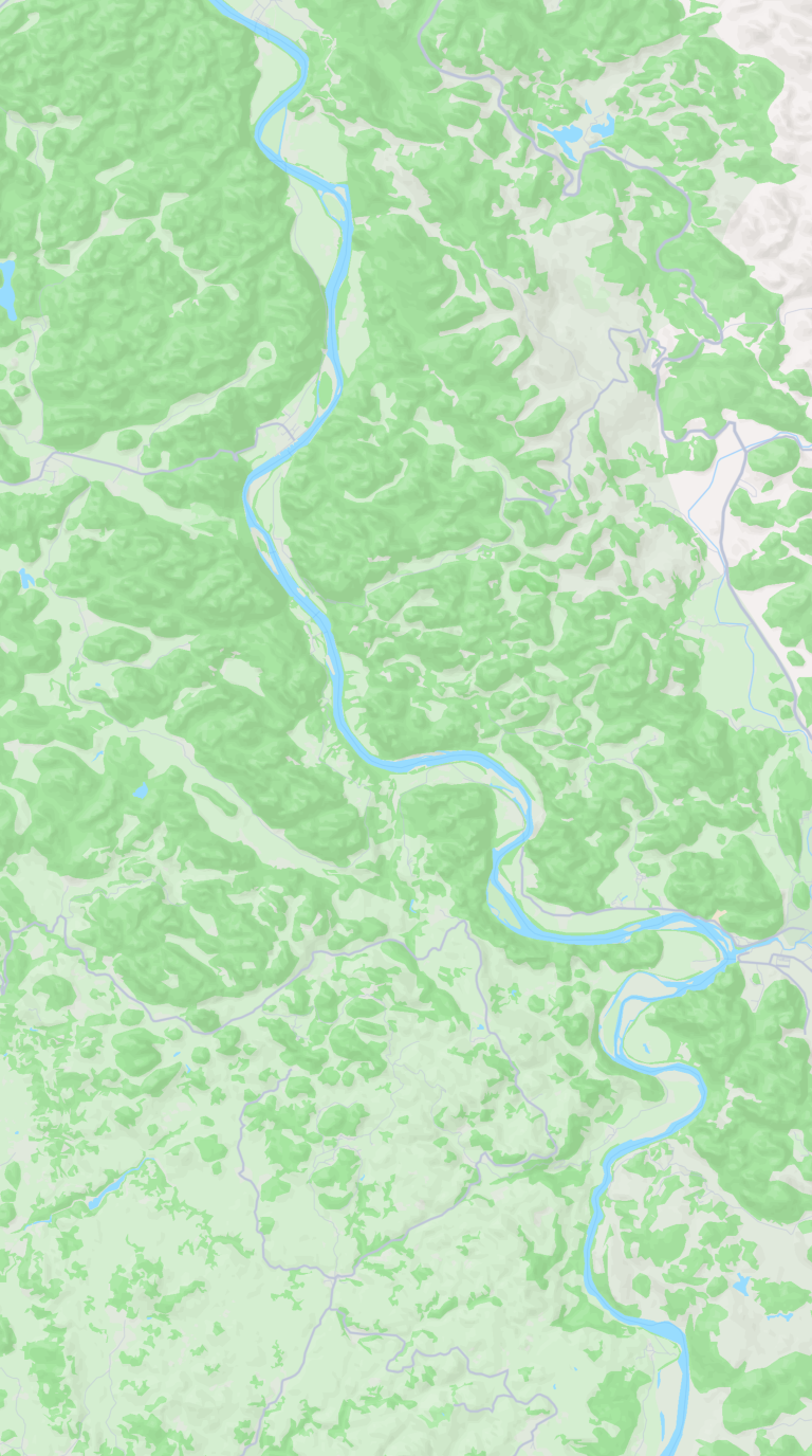
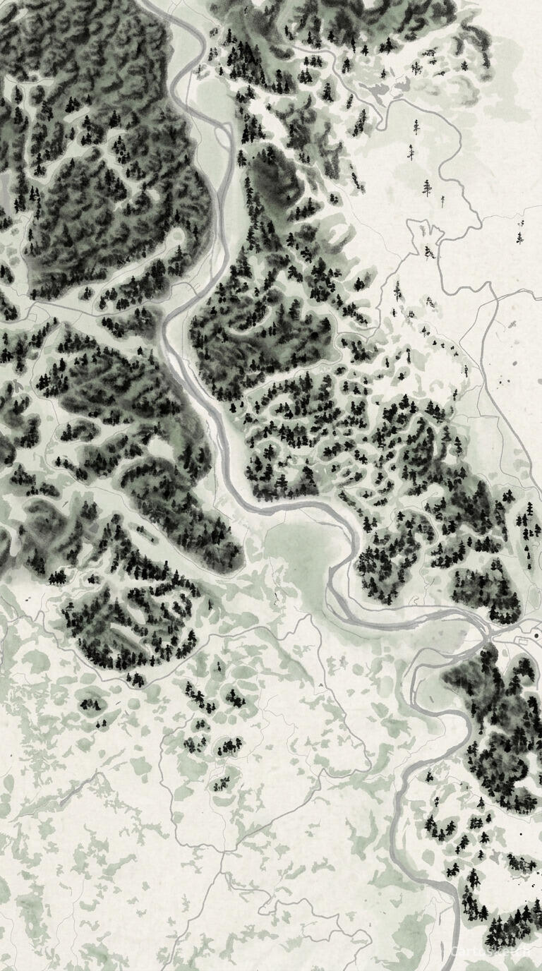 Cartosketch
Mapbox
Cartosketch
Mapbox
And on GPS routes
Direct API access does not solve the GPX problem. Gemini accepts text and image inputs; it does not parse track files. To generate map art of your marathon route via the API, you would have to: write a GPX parser, project the points to a Mapbox-style basemap, render the polyline to a canvas, snapshot it as an image, build a stats overlay, then call the model with that image as the base. That is most of Cartosketch.
Cartosketch ships that whole stack. Drop a GPX or FIT file into New Route; the browser parses it, draws the real polyline on a Mapbox canvas, and ships that canvas to the model. The stats card (distance, elevation, time) is rendered alongside. The output is a print-ready piece that matches the actual run.
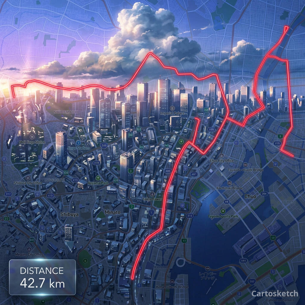 Cartosketch
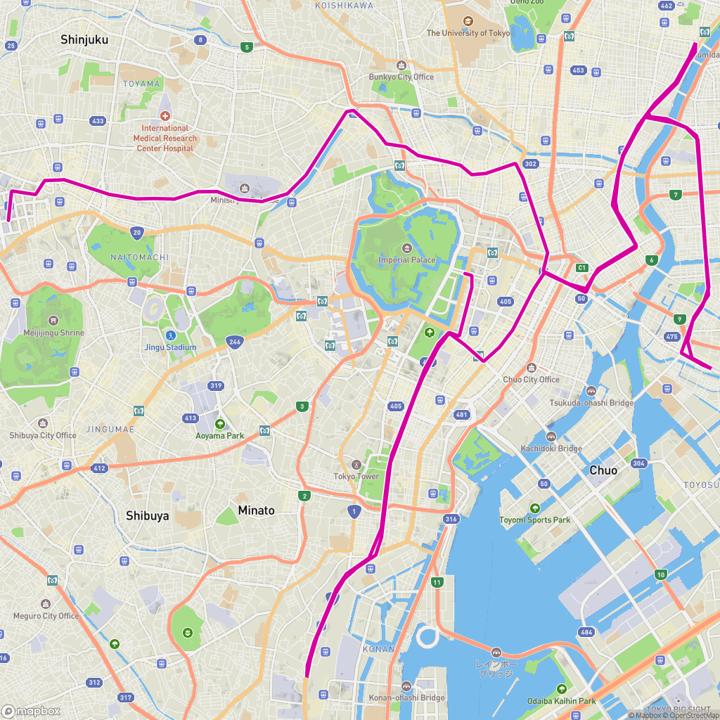
GPX on Mapbox
Cartosketch
GPX on Mapbox
Dimension-by-dimension
| Dimension | Gemini direct (AI Studio / API) | Cartosketch |
|---|---|---|
| Underlying image model | gemini-3.1-flash-image | gemini-3.1-flash-image |
| Mapbox capture as ground truth | You build it | Built in |
| GPX / FIT route ingestion | You build it (parser + canvas) | Built in |
| Curated style prompt library | Write your own | 17 tuned styles (Sketches::Styles) |
| Resolution tiering & 4K output | Default 1K; you wire higher | Up to 4K, plan-gated |
| Watermarked PNG origin + JPEG variant | You build it | Built in |
| Route stats card overlay | You build it | Built in |
| Print & commercial use | Under Google's terms | Included on every paid plan |
| Time to first printable poster | Hours to days (build the pipeline) | About three minutes |
When to use which
How Cartosketch wraps the same model
- Capture: a real Mapbox canvas (Standard or Satellite) or a GPX/FIT track rendered to canvas in the browser.
- Prompt: a per-style system prompt from a curated library (Sketches::Styles), not free-form text.
- Generate: gemini-3.1-flash-image restyles the canvas with the geometry preserved.
- Process: MiniMagick scales to your plan's tier (0.5K / 1K / 2K / 4K); a Cartosketch watermark is burned into the variant.
- Deliver: a full-resolution PNG origin and a watermarked JPEG variant are stored and served via CDN; you download up to 4K.
Frequently asked questions
- If Cartosketch uses Gemini, why pay for credits instead of using the API directly?
- If you only ever want one or two test images and you are comfortable with the API, going direct is fine. If you want a printable map or route poster of a real place, you are paying for the pipeline around the model — the Mapbox capture, GPX parsing, curated style prompts, resolution tiering, watermarking, and print-ready output.
- Will the output look the same as Gemini direct if I write a careful prompt?
- Quality will be in the same ballpark, but the geometry will not. Without a real Mapbox canvas as the input image, the model invents the streets, coastlines, and route shape. Cartosketch locks the geometry by giving the model the real map view to restyle.
- Can I plug my own prompts in?
- Today you choose from the 17 curated styles in the picker; we maintain those prompts so the result is consistent across places and resolutions. Custom prompts are on the roadmap but are not the main use case — most people want a printable result, not a prompt console.
- Which Gemini model is Cartosketch using right now?
- gemini-3.1-flash-image, the same image model exposed in Google AI Studio. The model is configurable on the backend so we can swap to newer Gemini image releases without changing the rest of the product.
New accounts get one free credit — no credit card required.